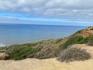
I have been a history geek for as long as I can remember. I love reading about the past. I also love beaches, especially ocean beaches. So today I am driving south on PCH to visit my cousins in Carlsbad but my first stop will take me further south to San Diego. I am going to a narrow peninsula between San Diego Bay and the Pacific Ocean where there is Fort Rosecrans National Cemetery, Naval Base Point Loma, the Point Loma lighthouse, and Cabrillo National Monument. This is what I saw during my visit.
I love the entrance sign with artwork of a ship on it.
I'll admit, I had no idea what Juan Rodriguez Cabrillo did to deserve a National Monument. Apparently, he was the first European to set foot on the West Coast of the United States.
"Juan Rodriguez Cabrillo led the first European expedition that explored what is now the west coast of the United States. Cabrillo departed from the port of Navidad, Mexico on June 27, 1542. Three months later he arrived at "a very good enclosed port," which is known today as San Diego Bay. Historians believe he anchored his flagship, the San Salvador, on Point Loma's east shore near the land that becomes Cabrillo National Monument. Cabrillo later died during the expedition, but his crew continued on, possibly as far north as Oregon, before thrashing winter storms forced them back to Mexico." - taken from the NPS website.
This area is on a Naval Base. These signs show the Naval Air Force planes and the Naval ships of the Pacific Fleet.
The monument for Cabrillo
The back side of the Cabrillo monument.
Hiking up to the lighthouse...
...I got distracted looking down while hiking uphill. Nice view of San Diego Bay.
There are a few informative signs for me to read because I am a history dork.
This is the Old Point Loma lighthouse.
Finally, some blue sky is visible.
The view of the Pacific Ocean from the lighthouse.
Walking up the backside of the lighthouse.
Two of the rooms in the lighthouse.
The overcast morning is giving way to blue skies with interesting clouds.
The "Kitchen Garden" behind the lighthouse.
Looking down the cliffs at the Pacific Ocean.
I started hiking along the cliffs...
...with beautiful views of the ocean...
...and hidden bunkers used during WW I and WW II for surveillance and protection.
This local was kind enough to pose for me.
Historical Exhibits are located in the former radio station on the cliffs.
Back to being above ground on the coastal trail.
I love great ocean views as much as I love walking through historical places.
This day keeps getting better...
...the closer to the ocean I get. These cliffs have a unique erosion pattern.
One of my favorite sounds is the surf crashing on the shore.
I am fascinated by the eroded cliffs...
...and the rocky shoreline. This hike down the cliffs is definitely worth the climb back up.
If you are asking yourself how many photos can this idiot take, the answer is way more than I post in this blog. I could have stayed here all day long, but I have family to see.
The view below me...
...the view above me.
This flat section is where most of these photos were taken.
The near-constant waves made this an exciting place to photograph.
Mother Nature always finds a way to impress me.
These four photos were taken only seconds apart as the wave...
...crashed on the rocks...
...and flowed toward me...
...then receded.
Waves...
...caves...
...and strange rock formations made this a wonderful hike on the shoreline.
The Pacific Ocean put on a great show for me...
...a wonderful way to start my day.
Cacti on the beach.
Fort Rosecrans National Cemetery.
I always stop to pay my respect to those who served our country.
Thank You Mr. Lattin


